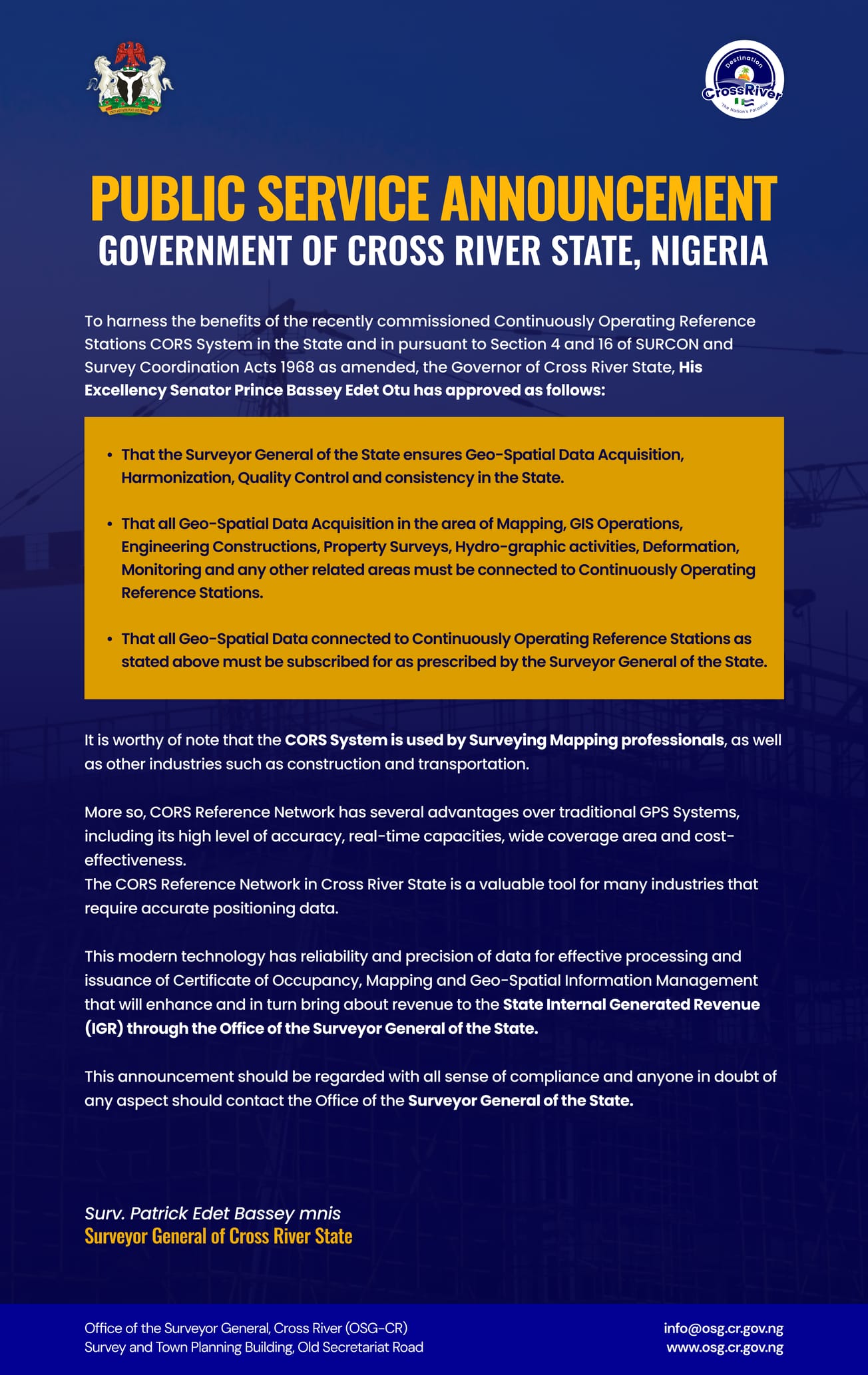
In a significant move to modernize data acquisition and infrastructure planning, the Cross River State Government has introduced the Continuously Operating Reference Stations (CORS) System, a major upgrade in how geo-spatial data is captured and managed.
The CORS System is a powerful tool that enables real-time, high-precision positioning data, which is essential for professionals in surveying, mapping, construction, engineering, and environmental monitoring. By ensuring consistent, harmonized, and quality-controlled data, the State is raising the bar for accuracy in development planning and land management.
What does this mean for stakeholders?
- All geo-spatial data activities across sectors—such as GIS operations, property surveys, hydrographic work, and deformation monitoring—must now connect to this CORS network.
- Users are required to subscribe for access to these stations, as guided by the Office of the Surveyor General.
- This system brings not just precision, but also accountability. It helps generate internal revenue while standardizing data that feeds into critical state-level decisions.
Beyond just a tech upgrade, this shift reinforces Cross River’s commitment to data-driven development, ensuring every structure, road, and project is built on a reliable foundation—literally and figuratively.
For more information or to comply with this directive, individuals and organizations are advised to contact the Surveyor General’s office directly.


